Planning for
a Resilient Belize City
The impacts of climate change present a growing challenge for communities all across the world. This map explores the climate change vulnerabilities facing Belize City, Belize, and suggests possibilities for strengthening ecosystems, buildings, critical infrastructure, and community resilience through careful planning.
This map was made by the 2020 NYU Capstone Team (Joseph Baietti, Carrie Eidson, Jah-Milka McClean, David Zhong) for the Belize Association of Planners.
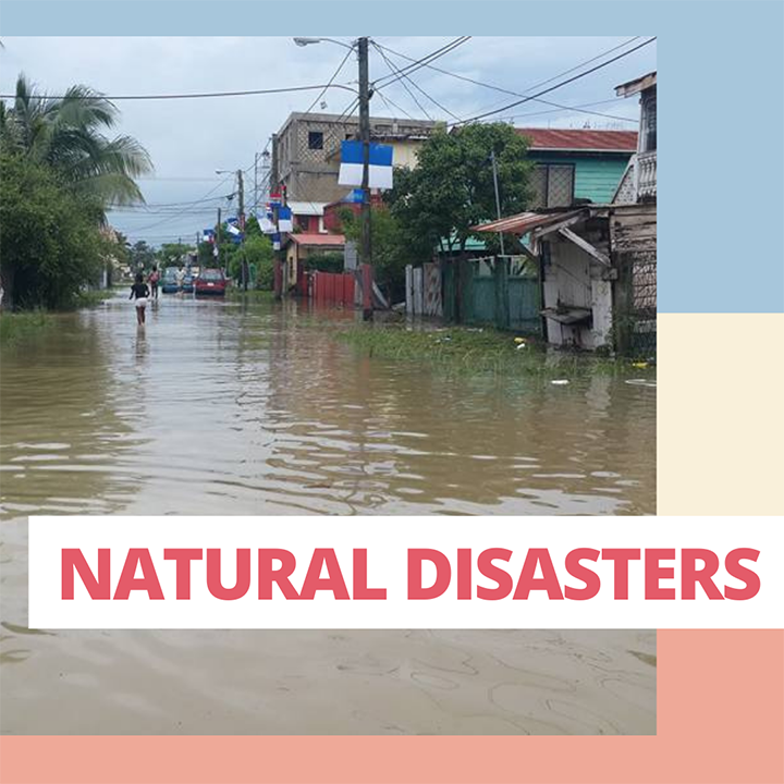
Belize City lies entirely at or below sea level, making it vulnerable to storm surge and rising sea levels associated with climate change. The city is expected to see damaging and life-threatening urban floods at least once every 10 years.
Most of Belize City is in the 100-year floodplain, meaning there is at least a 1% chance that nearly all of the city could be inundated during an extreme hydrological event. Climate change is making such storms more common, and there is evidence that "100-year floods" could happen as often as every 1 to 20 years. Without careful intervention, flooding in Belize City will become increasingly destructive and severe.
However, flooding itself is only one aspect of climate change vulnerability. Because the health and prosperity of Belize City and its residents are so linked to the natural environment, climate change impacts can manifest across many different aspects of daily life.
Urban planning helps to identify climate risks and vulnerabilities so that citizens can take informed action to better protect themselves and their city. The Belize Association of Planners is a proactive professional planning organization committed to partnering with communities and actors in the urban areas of Belize to build resilience to natural hazards and climate change.
As we will show in this map, there are many areas where urban planning is needed to address the vulernabilities of Belize City and its residents.

Belize Association of Planners Board of Directors. (Image courtesy Belize Association of Planners)
Flood projections for Belize City
Currently, flooding in Belize City is most severe in the lowest lying parts of the city (Faber's Road, Holy Emmanuel, Orange Street, Queen Street, Hyde's Lane, Freetown Road, Belama, and Bellavista), and in the river basin and lagoons that are part of the natural and man-made drainage system.
However, in more extreme events, such as seen in the 100-years return, storm surge will easily move beyond low-lying and coastal areas to overwhelm the inner parts of the city.
Water depth on these maps is shown in meters (one meter equals slightly more than 3 feet). As such, projected flood depths will range from .65-.98 feet during lighter events, to depths exceeding 13 feet during more intense flooding, as shown on the map in bright pink.
Flood maps courtesy of Emerging and Sustainable Cities Initiative (ECSI).
Substandard buildings
Vulnerability to climate change, as well as the flooding and severe wind associated with hurricanes and tropical storms, is dramatically increased by low-quality or precarious buildings, particularly when they are concentrated in one area. These buildings are more likely to collapse or be damaged during storms, increasing the risk of flying debris, injury, and loss of life.
About 42% of Belize City residents live in housing stock that is considered low-quality.
Buildings are considered low-quality if they lack some basic residential infrastructure, such as running water, electricity, or sewer. These factors can negatively impact residents' health, and can be worsened during severe weather events, making it more difficult to shelter in place. Low-quality buildings are often made with material such as plywood or metal sheets, which are highly vulnerable to winds and flooding. These buildings are commonly single-family homes concentrated in lower-income areas with unpaved roads and on the southwest side of Haulover Creek.
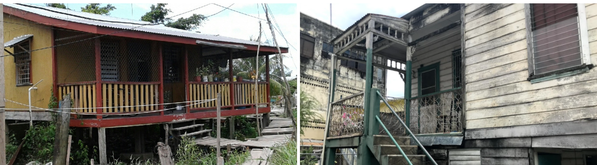
Examples of low-quality housing in Belize City. Images
courtesy of Belize Association of Planners.
About 3% of Belize City residents live in housing stock that is considered precarious.
Precarious buildings lack all basic residential infrastructure. These structures are often built with waste materials and salvaged plywood and metal sheeting to support walls and roofing structures. These homes are very unstable and are normally elevated from ground level by pillars.
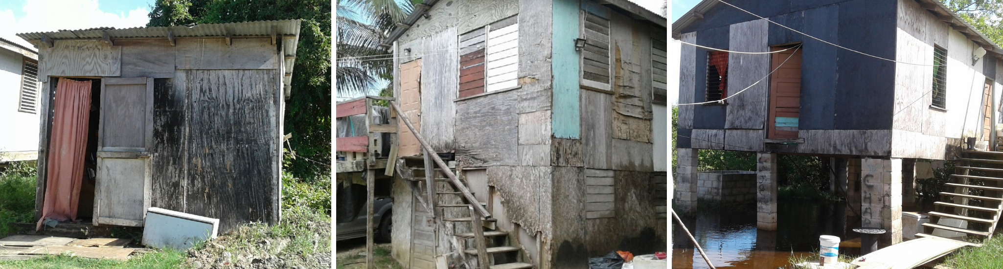
Examples of substandard housing in Belize City. Images
courtesy of Belize Association of Planners.
Low-quality and precarious buildings tend to be located on the south side of the city, and in more flood prone areas, further increasing the flood exposure risk of these residents. The map depicts the general areas where buildings of these conditions are concentrated.
Informal settlements
Precarious buildings are commonly found in informal settlement areas—unplanned areas where property rights are unestablished, or land is illegally occupied. Homes in these areas are usually poorly constructed by owners through whatever resources they can find. This type of home construction is not suitable for safely weathering natural disasters or flooding.
In Belize City, informal settlements are found in the lowest areas of the floodplain, making these residents especially vulnerable to climate change impacts. They also face significant socioeconomic challenges, including poverty and marginalization. While residents of Belize City's informal settlements are especially affected by climate change, they can also be easily erased from political processes and planning due to factors such as citizenship status or lack of property rights.
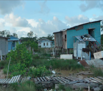
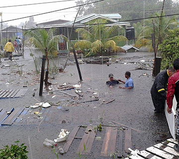
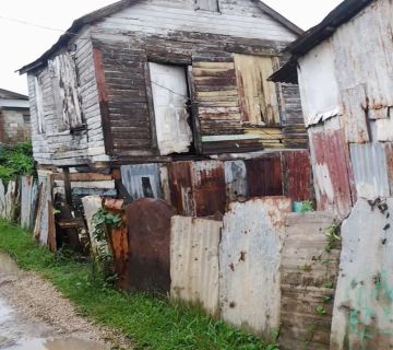
Flooding and substandard housing in Krooman Lagoon. Images
courtesy of Belize Association of Planners.
Krooman Lagoon and Gungulung, two of Belize City's largest informal settlement areas, are located on ecologically sensitive, flood-prone land. While some residents of these settlements are knowingly squatting, others were given informal arrangements to access the land. However, homes constructed on publicly owned land (such as Krooman Lagoon) are considered illegal. As such, these residents face a constant displacement threat.
Residents of these areas face significant public health hazards as well. These communities have no access or unregulated access to electricity, and residents often run a network of informal electrical wires from existing utility lines. These live wires are easily blown down during storms or times of heavy winds, making electric shock a very real danger if wires may fall into standing water or onto walkways.
Additionally, informal settlements are not served by sanitation services, and residents often use latrines or toss bagged waste into outside areas. Waste can contaminate the standing water that permeates these communities, which exposes residents to dangerous bacteria and diseases. Children are especially at risk for adverse health effects if they walk through or play in water that has been contaminated.
Critically, the construction of these informal settlements in ecological sensitive areas also undermines the climate resilience of Belize City. As this Belize Channel 5 story from July 2014 shows, a shortage of affordable housing in the city is driving development of Krooman Lagoon, and destroying the mangrove forests of this area in the process. As we'll discuss in more detail in a moment, mangroves serve an important function in protecting the city from storm surge and climate change impacts.
The informal settlements in Krooman Lagoon and Gungulung (shown on the map) are both located in ecologically sensitive areas. Krooman Lagoon is publicly owned land that is designated as an environmentally protected zone. This land is highly unsuitable for housing as it is swampy and flood prone.
As this November 2020 report from Belize City's News Channel 5 shows, residents of Krooman Lagoon and other flood-prone areas have made many attempts to adapt to the flooding they experience, but greater intervention is needed to protect these communities from flood risk.
Environmental degradation
Mangrove wetlands are one of Belize City's most prized natural resources. In addition to being an attractive amenity that draws in international tourists, the mangroves are a vital part of Belize's ecosystem and are home to many plant and fish species.
But perhaps moe critically given Belize City's high flood risk, it is important to emphasize the mangroves role in flooding and climate change resilience. Mangroves serve as natural storm protection. They are buffers against heavy winds and waves, and can reduce the force of storm surge before it hits homes and businesses. Mangroves are also flood basins, which means they are capable of serving as reservoirs that can store large amounts of storm water. This reduces pressure on manmade stormwater infrastructure, such as the canals, and enables it to perform better. Mangrove forests also protect inland freshwater resources from saltwater intrusion.
However, development in ecologically sensitive areas is reducing Belize City's mangrove wetlands. From 1980 to 2010, Belize City and the nearby cayes lost 2,074 acres of mangrove coverage.
The decline of mangroves is driven by unplanned development, which includes not only informal settlements such as Krooman Lagoon, but also suburban commuter towns that are growing to the north and west of Belize City. In both cases, the lack of low- and middle-income housing is pushing development into new areas, including mangrove forests. In addition to reducing the flood resilience of Belize City and the surrounding region, construction in former mangrove areas also exposes those homes to a heightened flood risk.
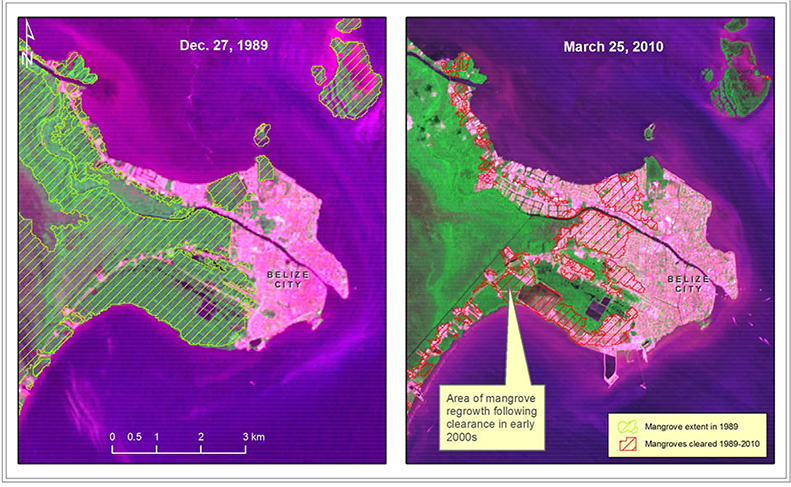
These satellite images are from the CATHALAC study "Identification of Threatened and Resilient Mangroves in the Belize Barrier Reef System." Click to expand.
Sprawl and unplanned development
The growth of commuter towns and suburbs to the north and west of Belize City is propelling a development push into ecologically sensitive areas. These towns are rapidly gaining population, even as Belize City itself is losing population. In 1970, Belize City was home to 78% of the Belize District population, but by 2010, it held only 60 percent of the district's population.
Much of this population movement is related to expense: suitable land within Belize City is scarce, driving up the price. Additionally, low-rise, single-family homes are the most common housing type, which limits density and the number of units on the market. Climate change will likely make this worse. As mentioned above, more than 40% of Belize City's housing is low-quality, making it highly vulnerable to being destroyed in the event of a severe storm. Additionally, competition for the least flood-prone land will likely drive up prices in those areas, potentially displacing lower-income residents.
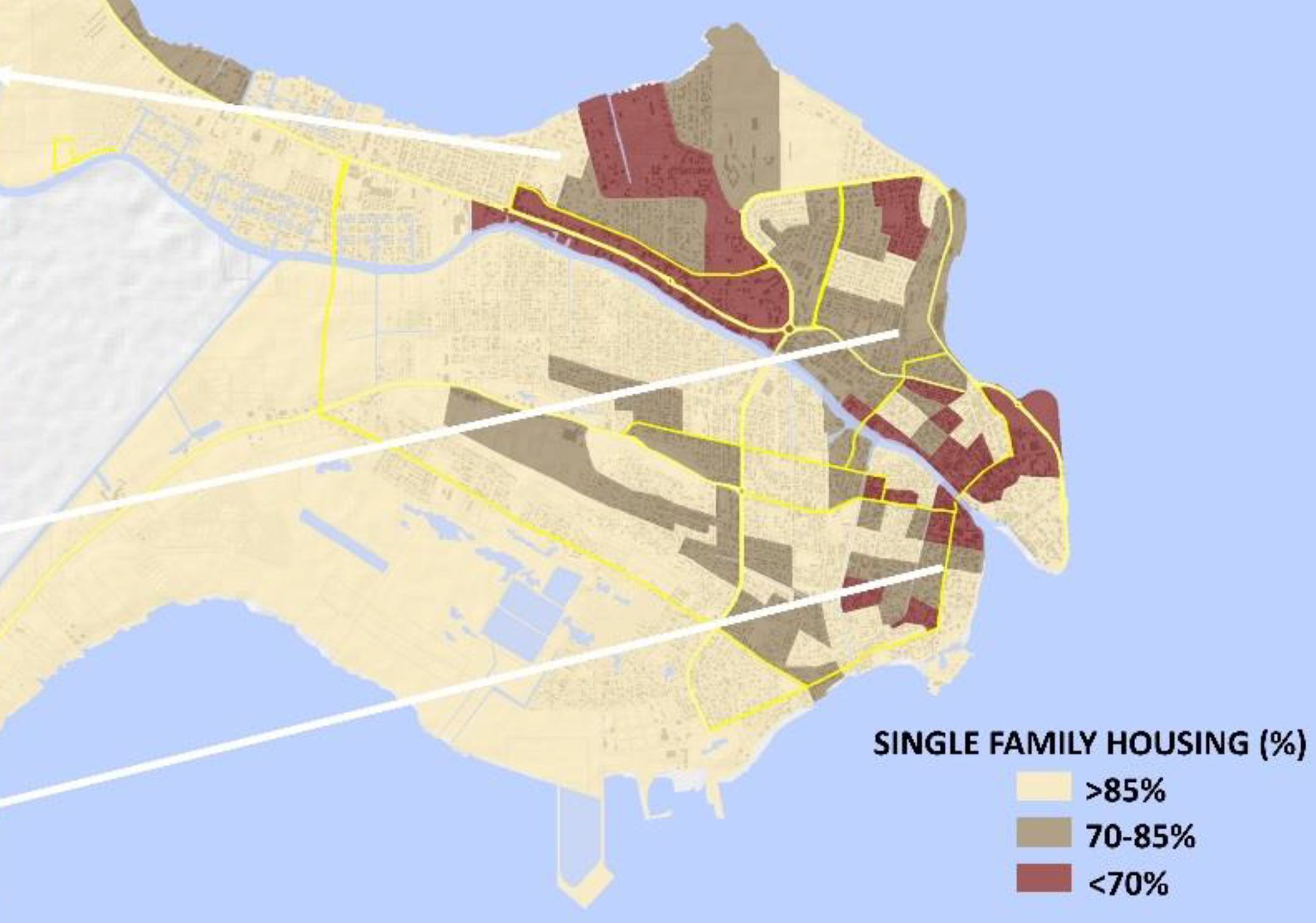
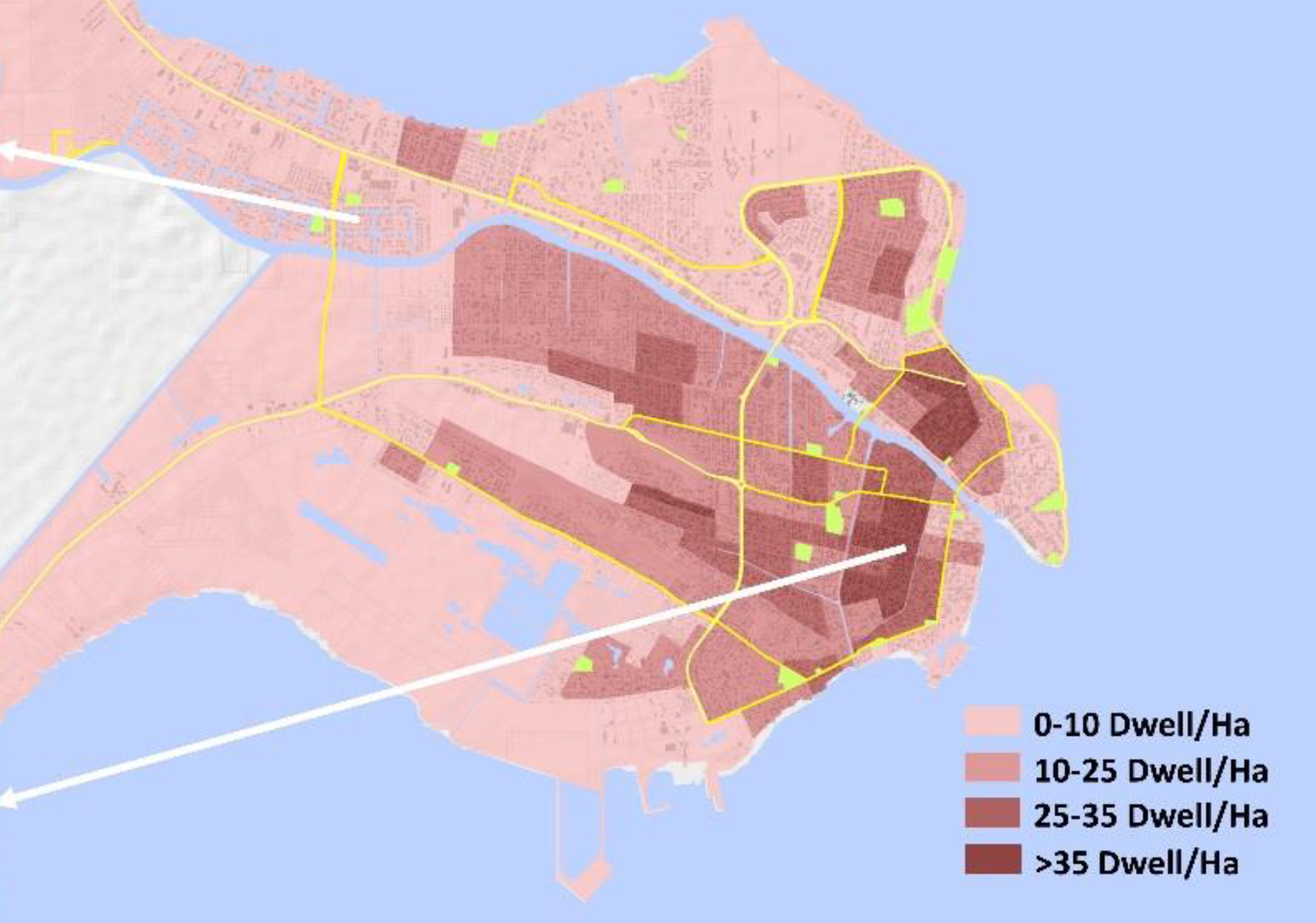
Land use maps courtesy of Emerging and Sustainable Cities Initiative (ESCI). The map on the right measures dwelling density in hectares. One hectare = 2.47 acres. Click to expand.
People who can't afford to live in the city, yet must commute in for work, are increasingly moving to towns along the north and west highways including Ladyville, Hattieville, Burrell Boom, 8 Miles, and Los Lagos. However, this development is proceeding with little consideration of the regional impacts, including destruction of sensitive natural areas and increased car congestion.
There is no efficient mass transit to connect the commuter towns and Belize City. As such, these commuters largely travel into the city via personal vehicle, creating a spike in congestion and chaotic traffic. This is evidenced by regular bottlenecks on the highways, particularly at the Haulover Creek crossings. There is an added danger here that, in the event of severe storms, these congested highways (which are themselves flood-prone) also serve as evacuation routes.
Footage from June 2020 shows the collapse of a portion of the George Prince Highway connecting the Belize District and the Cayo District. As explained in this report, floodwaters can compromise the materials of highways, heightening the risk of collapse. Had this occurred during an evacuation, citizens could have been stranded in a dangerous area.
One of the fastest-growing commuter towns is Ladyville, which has a population of about 5,400 in the last (2010) census and is home to the Philip Goldson International Airport. This area is seeing increasingly concentrated industrial, office, commercial, and airport land use.
The population of Ladyville has more than tripled in the last 30 years. Given Ladyville's average annual growth rate is around 7%, this trend is expected to continue.
Ladyville experiences severe flooding and drainage issues. The area is in a natural drainage basin that was once filled with marshlands and mangrove forests. Today the area remains highly susceptible to flooding from heavy rains but is increasingly losing its natural flood protections. Due to its location on the banks of the Belize River and close proximity to the Caribbean Sea, this suburb is also highly vulnerable to storm surge.
Loss of vibrancy
The growth of the suburbs is also related to the decline of the center city. Belize City used to be the capital of Belize and also the center of economic, political, and cultural development. However, due to severe hurricanes, the capital was moved to Belmopan in 1970. Following the removal of the administration function, the downtown area of Belize City gradually suffered from economic stagnation and urban depression.
A lack of economic planning in the 1980s further contributed to the decline. Without a variety of businesses in the downtown area, most shops were closed by evening. Downtown became a dead zone that was poorly maintained and poorly lit, which attracted nefarious activity. The area soon became associated with Belize City’s high homicide rate. Domestic gangs active in drug trafficking and robberies frequent the area. As the country’s role in the international drug trade has grown, Central American gangs and Mexican drug trafficking groups have also established a presence. Many once prosperous neighborhoods have become dangerous even for local citizens.
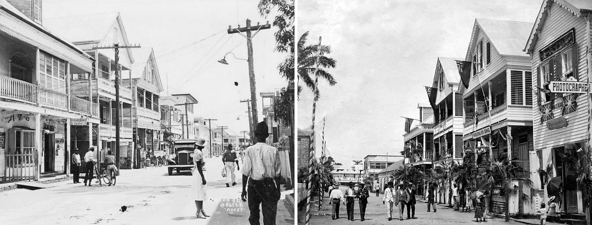
Queens Street in 1908
For the past few decades, Belize City's historic downtown has been less enjoyable for residents and visitors.
Given these factors, the downtown area attracts very little tourism. As many tourists come to Belize for its lovely natural amenities and beautiful offshore islands, they are not overly interested in staying in Belize City. Although most flights and cruise ships regularly arrive in Belize City, most tourists immediately depart for other destinations.
Additionally, although many historic buildings remain, downtown also shows signs of blight, and some culturally significant buildings have had to be demolished due to disrepair or damage from natural disasters. Public spaces and parks are also used less frequently, and their maintenance is neglected. As a result, residents may feel these areas are unsafe.
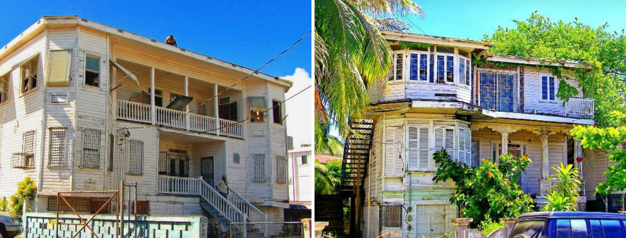
Historic properties in need of restoration. (Photos courtesy The Belize City House of
Culture and Downtown Rejuvenation Project.)
The violence brought by gangs is a major challenge to the economy of Belize City. It compromises residents’ quality of life, exposes youth and children to trauma, and kills or injures hundreds of people annually. As shown on the map, many areas frequented by gangs surround downtown Belize City. This creates major incentives for tourists to avoid visiting Belize City.
While some efforts, including the Downtown Rejuvenation Program of Belize City, are trying to create a better tourism environment, effectively addressing the problem will also require an examination of the underlying issues that drive young people to join gangs, including poverty and a lack of economic opportunity.
Resilience through planning
As we've shown, Belize City faces significant climate change challenges. However, they are not insurmountable. Urban planning can help to image what a more equitable and resilient Belize City would look like, and create a clear path to achieving that vision.
At present, planning in Belize City is not as strong as it could be. There is limited coordination between the national and local government, and between Belize City and the surrounding commuter towns.
In the next sections
of the map, we will discuss planning interventions that can help improve quality of life and transform Belize City into a leader in climate resilience. However, it must be emphasized that greater cooperation between the regional
and national governments, as
well as broader
public support for planning efforts, is needed to make this vision a reality.
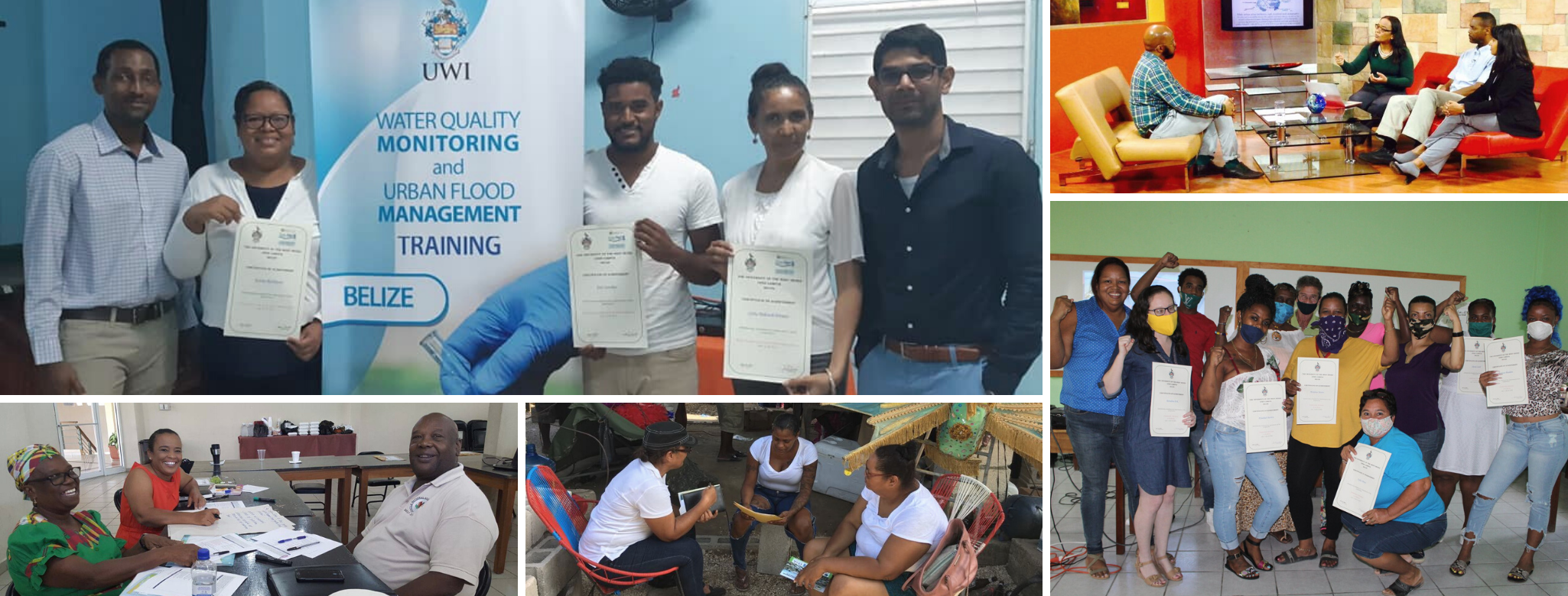
All images courtesy Belize Association of Planners.
Updating and enforcing building standards
National building standards are neither specific nor well enforced. Further, the existing standards are not designed with best practices for climate change and natural disasters in mind, such as considerations for the impacts of storm surge, erosion, and flooding.
An update to Belize's current building standards, as well as improved local enforcement in Belize City is critical. New building codes should consider climate resilient elements, such as elevation of living areas and utilities, and more specific material requirements for construction and foundations. These specifications will help protect residents and property from flood waters and other natural hazards. Additionally, coastal setbacks can be used to establish a protective area between housing and the water's edge (or sensitive ecological areas, such as mangrove wetlands) to help address coastal erosion.
Updated building standards should be designed in consideration of location and building type. Different standards could be created for existing structures to establish a baseline for safety, with more stringent standards applied to new construction. Standards could also be applied differently across locations. For example, there could be higher elevation requirements for structures in the floodplain or open foundation standards for structures in areas with high rates of erosion.
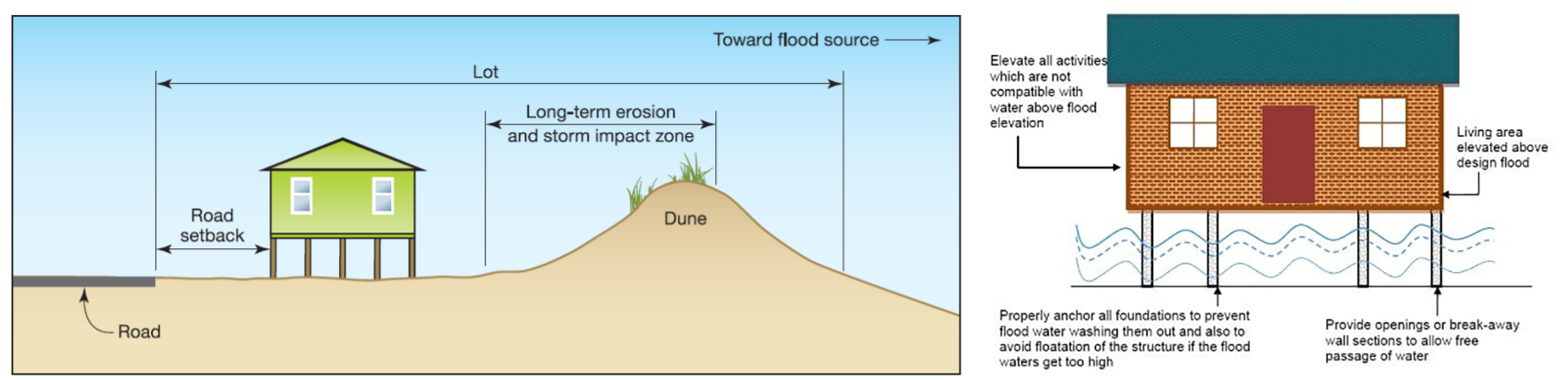
Images courtesy Federal Emergency Management Agency. Click to expand.
Improved enforcement of building codes can also help with the upkeep of properties and the monitoring of vacancies, which may help improve public safety and reduce crime. However, it is important that any heightened enforcement be paired with educational campaigns and resources to help property owners navigate requirements. These campaigns should be inclusive to residents in low-quality housing, which often includes women-led households, migrants, and other minority groups. New and updated building requirements should also be paired with access to capital to make necessary improvements. The government of Belize could establish housing rehabilitation loan and grant programs targeted to homeowners and building owners to encourage improvements and incentivize redevelopment.
Improved building codes can also be developed in coordination with land use maps that can restrict new construction in areas of heightened flood vulnerability.
Addressing congestion and mobility
The congestion along the northern and western highways suggests these routes provide sufficient demand for transit lines to connect the commuter towns with the city core. However, comprehensive transit planning is needed to prioritize buses and incentivize commuters not to drive.
Bus and transit reform is also needed within Belize City proper, as routes and schedules are inconsistent. Elderly riders and riders with disability may experience gaps in service as they are not given proper time to board the bus or drivers simply do not stop for them.
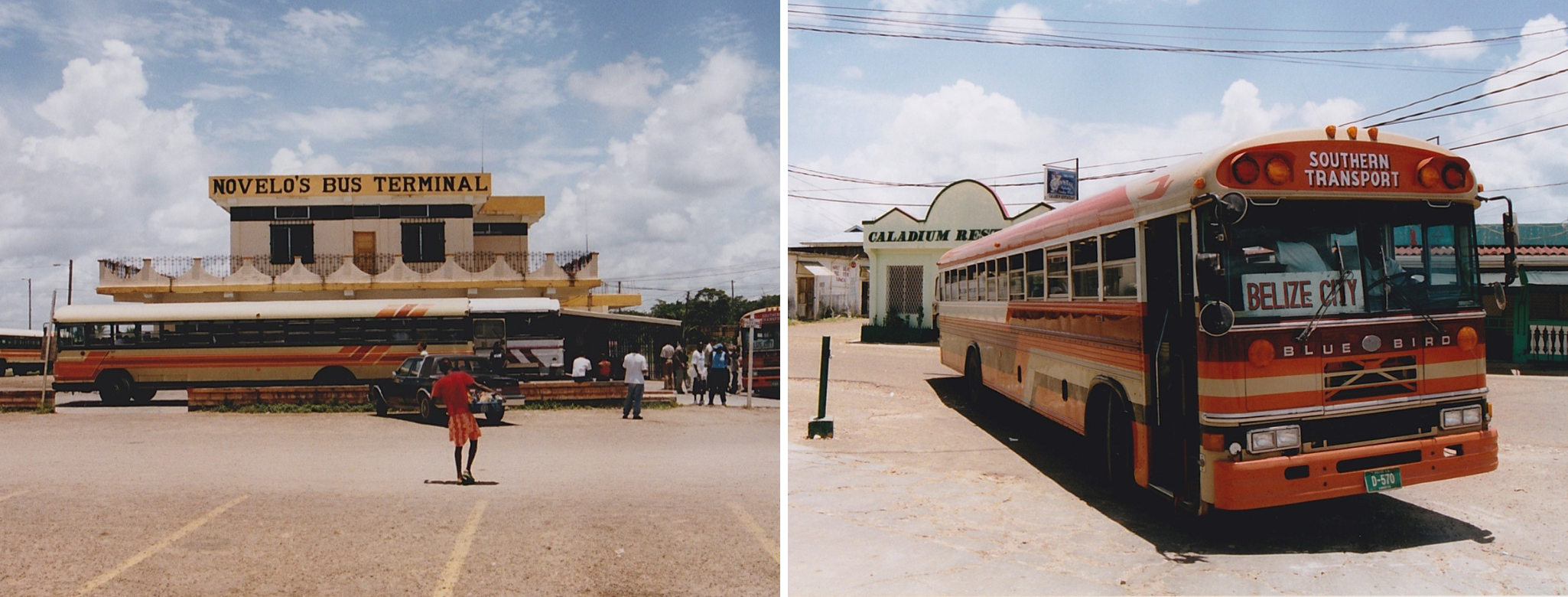
The bus terminal at W Collect Canal as pictured in 2014. (Photos by Jasmine Halki, used under Flickr Creative Commons license.)
Standardizing bus routes, stops, and schedules across private companies would make the system more attractive to residents and visitors. It is especially critical to improve stops and schedules so seniors and riders with disabilities have more equitable access to the buses. A centralized fare collection system, such as a refillable transit card, would also make it easier for commuters to utilize the system. Incentivizing modernization of the buses, especially in regard to accessibility features, would also help make the buses more accessible for seniors and riders with diverse abilities.
Additionally, Belize City needs to prioritize adding bike lanes and improved pedestrian walkways. To start, the city can emphasize the creation of multimodal corridors throughout the downtown area by adding bike and walking paths that connect to water taxi stations and the bus terminal at West Collect Canal.
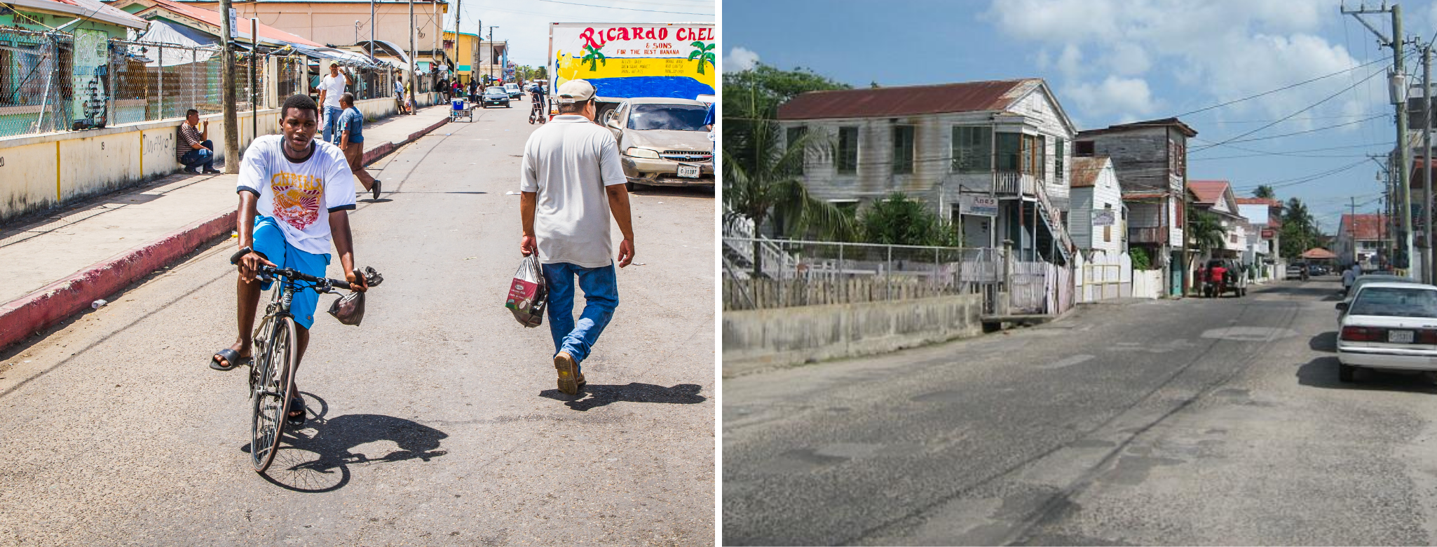
Adding dedicated bike lanes can help to safely separate bike riders and cars. Many streets in Belize City also need sidewalks to separate pedestrians from vehicular traffic. (Left photo from Inter-American Development Bank, right photo
by Steve Monty. Both used under Flickr Creative Commons License).
Improving mass transit and bike and pedestrian pathways has the added benefit of reducing the number of cars on the roads, which will lower Belize's greenhouse gas emissions. Though Belize contributes less than 0.01 percent of the total global emissions, these actions would still help support international mitigation efforts and show Belize to be a leader in climate change planning.
However, comprehensive transit reform will require extensive coordination and cooperation, not only among the Belize City Council, Ministry of Transport, and the private sector, but also between the Belize City Council and the governments of the suburban commuter towns. The creation of formal bodies, such as a metropolitan planning commission, can help spearhead these efforts, and work to develop critical guidance, such as a regional master plan. A regional body could also address the need for an airport that is located in a less flood-vulnerable area than Ladyville.
Protecting vulnerable populations & natural areas
Because Belize City's informal settlements are located in ecologically sensitive areas, these developments threaten the city's broader climate resilience and are unsafe for residents. This is especially true for Krooman Lagoon.
Belize City Council is making efforts to secure land, move the residents of Krooman Lagoon, and restore the mangroves. However, any plan for Krooman Lagoon or other informal settlements must involve a consideration of the underlying issues of poverty and socioeconomic vulnerability that drove these populations to live in such risky areas in the first place.
Many residents of informal settlements have jobs that are intrinsically tied to the city. They also need to be able to access services in the city, including health care and schools. Moving them could disrupt economic and social networks, and be harmful, if not done carefully. This is especially critical for women and children.
Around the world, people living in informal settlements are also often invisibilized by their government. Commitment to social justice means that it is important that any plans for relocation be done transparently, and with the involvement and support of the affected community. Additionally, while City Council works to secure new land, the community's other pressing needs must not go unaddressed.
As this video shows, the walkways of Krooman Lagoon are very vulnerable to flooding. One way the city can provide immediate assistance to these residents is by rebuilding these walkways so they are elevated and protected from water.Creating a formal plan for the future of Krooman Lagoon, in partnership with residents, presents one path forward. The plan should involve a phased timeline so the community knows when relocation would happen. Additionally, the plan should create a transition team of planning and health care professionals to address the community's essential needs both now and after the relocation. This should include preventive care and health screenings, especially for children; job training and employment placement assistance; and basic flood defenses while the community remains in the lagoon, including regular maintenance of the elevated walkways and materials to fortify homes from water. Many elements of this program could be offered to other informal settlement communities as well.
It is also important to note that commuter towns such as Ladyville are also pushing into ecologically sensitive areas, including mangrove forests. Broader protection of the mangrove areas is another reason why comprehensive regional planning for the Belize City metropolitan region is critically needed.
Revitalizing downtown
Belize City has just completed the The Belize City House of Culture and Downtown Rejuvenation Project (BCHCDRP), a joint project of the Government of Belize and the Taiwan International Development Fund. The project’s goal was to preserve and revitalize historic colonial-style architecture, and introduce amenities to the downtown area, including botanical gardens and boardwalks.
The BCHCDRP created an "EcoMuseum Zone" to guide visitors through historic sites in downtown Belize City. Visitors can download the “Belize City EcoMuseum App” on their mobile devices to get directions to sites of interest. Some important historical attractions that have been preserved and revitalized include the colonial Supreme Court, St. John’s Cathedral, and Belize Heritage Plaza.
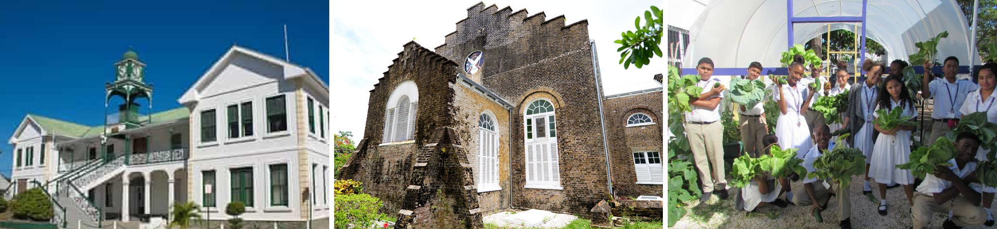
(From left) Supreme Court of Belize, St. John’s Cathedral,
and The Anglican Cathedral College Urban Garden. (Photos courtesy BCHCDRP.)
With the EcoMuseum Zone completed, it is important that Belize City Council continue to build on the work of BCHCDRP and make downtown better serve all residents of Belize City. There are many ways planning can help with this endeavor.
For one, refurnishing buildings to add affordable apartments over commercial spaces would add desperately needed housing units. These new residents would also serve as a customer base for businesses, and help keep downtown lively at night. Incentivizing a variety of local businesses to operate downtown, especially in the evening and at night, is also needed to restore vibrancy. Installing more streetlights could also be a simple first step for improving public safety and potentially reducing the occurrence of crime.
Other new elements could include green amenities and vegetation, and murals or public art that celebrate Belizean culture. Walking and biking pathways could be added to not only improve safety downtown, but also to connect the area to transit hubs, such as the bus terminal on W Collect Canal. This will make it easier for tourist to discover and explore downtown. All these measures will help bring more business to local shops and restaurants.
However, if downtown is to be revitalized as a hub of new development, long-term planning must also consider the effects of climate change. Belize City Council should begin planning now to reduce future flooding and storm impact on this revitalization project. This will require improved regulatory tools, including comprehensive zoning and a master plan that emphasizes climate resilience.
Sites of interest
The EcoMuseum Zone, the and downtown revitalization project more broadly, have multiple goals, including restoration of historic buildings, redesign of public spaces, and community empowerment. Some notable sites and projects are listed here.
Belize Heritage Place
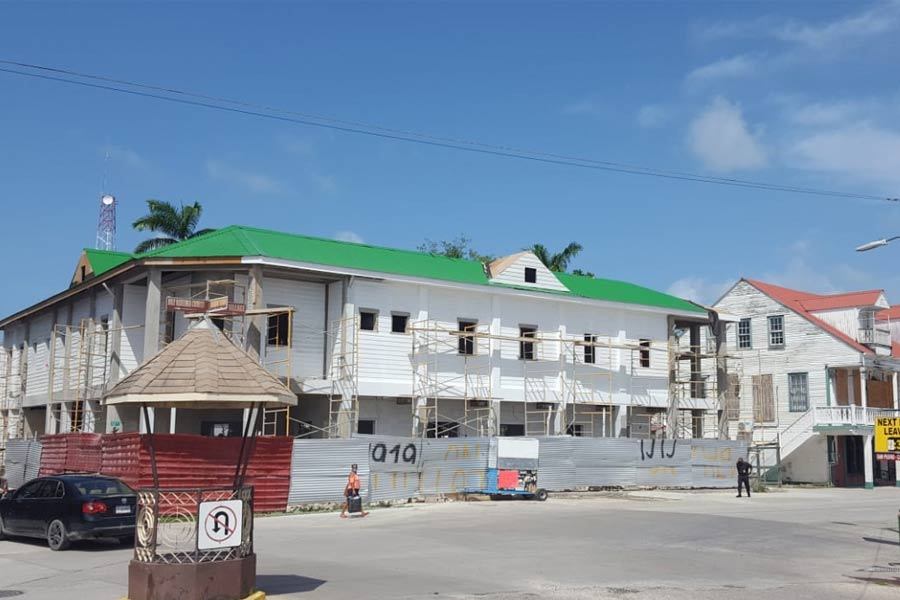
Dating back to 1920, this site was originally known as Belize Stores. Though the original building was destroyed by fire in 2002, restoration on the site began in 2020. It will
be the future home of the EcoMuseum Welcome Center. (Image courtesy BCHCDRP)
St John's Cathedral
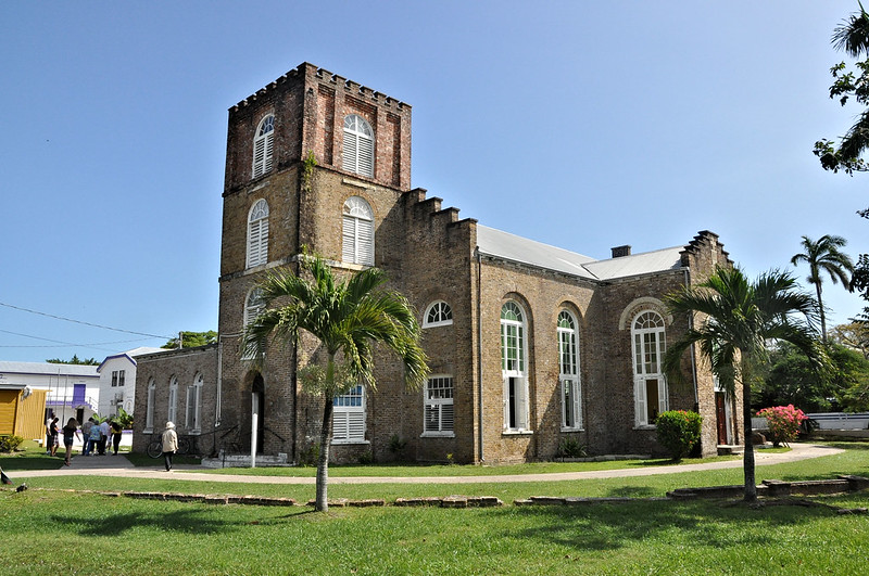
Built in 1812, this site is the oldest historic building in Belize. (Photo used under Flickr Creative Commons license.)
Supreme Court of Belize
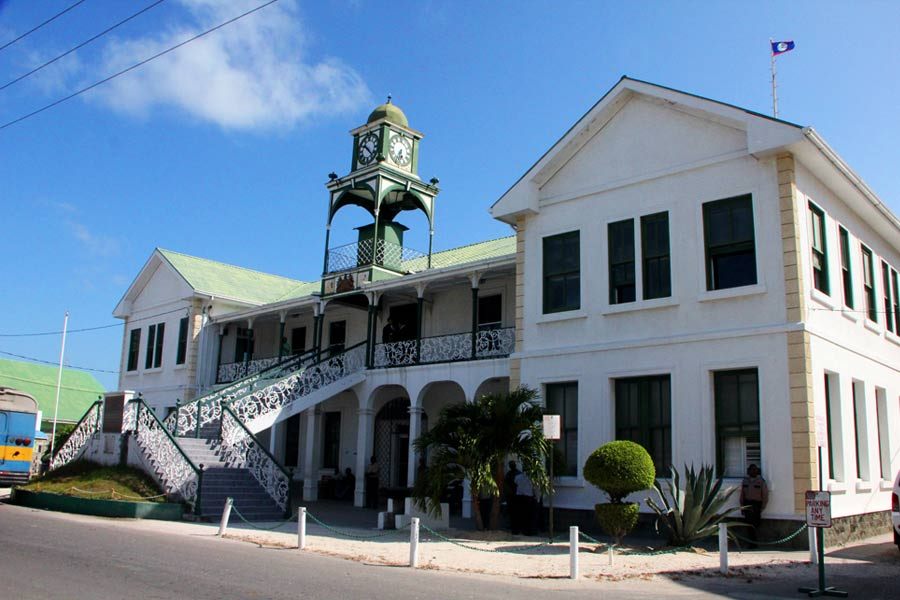
This building, originally built in 1926, is the third court house that has existed on this site. It is currently undergoing restoration, including to its historic clock. (Image courtesy BCHCDRP)
Big Wesley Church (Memory Site)
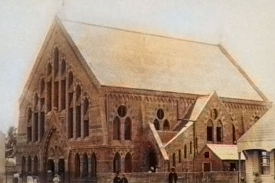
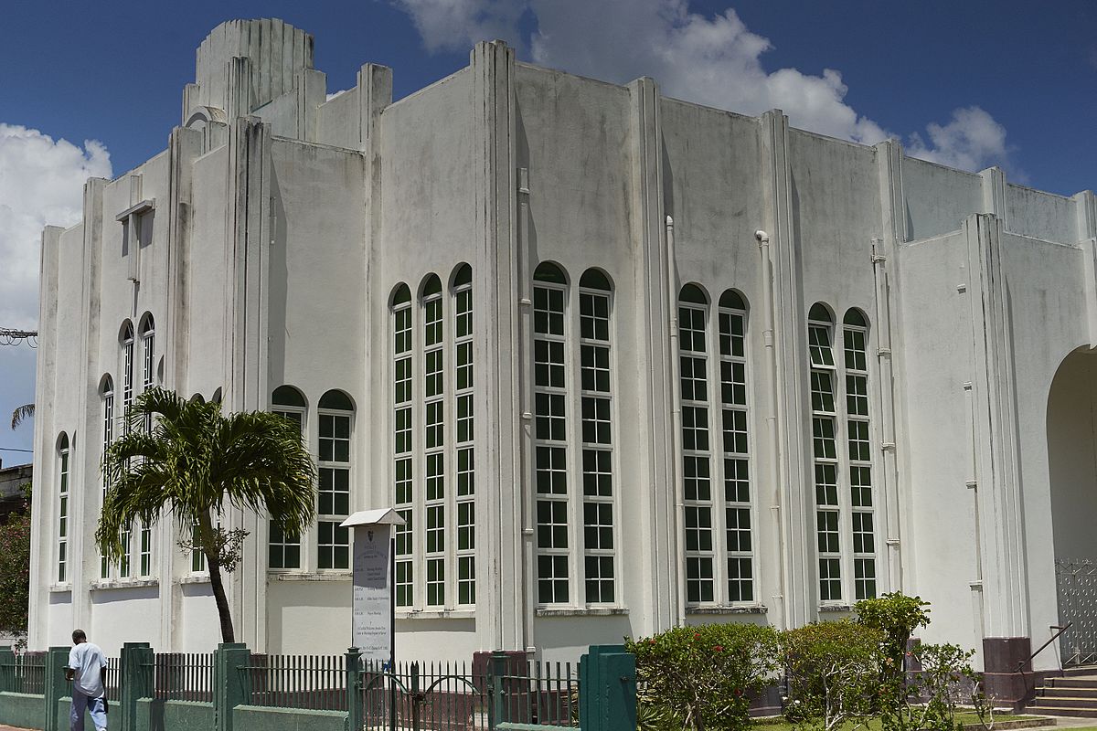
The first Wesley Church was built in 1829 but was destroyed by fire in 1863. A second church on the same site was again destroyed by hurricane in 1931. The current structure,
built in 1951, is designated as a "memory site" to honor
the architectural and cultural history of Belize City. It is also an important reminder of the need for climate resilience. (Images courtesy BCHCDRP and Wikicommons.)
A deeper dive into planning for resilience
Urban communities in Belize are confronted with many challenges today. The issues we've explored in this map represent only a portion of the work that remains to be done. With thoughtful planning, Belize's urban areas can become international examples of climate change action, and home to inclusive, resilient, and thriving communities.
The COVID-19 pandemic presents additional and far-ranging implications for Belize City, and the health and resilience of its residents.
The pandemic is exacerbating existing vulnerabilities, harming the local and national economy, and threatening public health. As Belize City continues to deal with the impacts of COVID-19, resilience and climate change awareness must be centered in the planning response and recovery.
Explore the resources below to learn more about the climate change and COVID-19 related challenges that Belize City must face, and how urban planning can serve to guide a sustainable path forward.